The Belgian writer David Van Reybrouck, when he first saw the gigantic estuary of the Congo River, starting point of colonizers and missionaries, whose powerful jet of debris, earth and trees transforms the ocean into a murky soup for hundreds of kilometers, immediately associated this image with a person who had cut his wrists and held them under water, but forever.
I thought back to this passage from one of the most appreciated African reportages (Congo, Feltrinelli 2014) when I found myself in front of, or rather I literally crossed, some of the rivers that probably most characterize the immense country of central Africa: the rivers of people, motorcycles, food and waste of all kinds that flow without interruption in the streets of Kinshasa and the underground ones, which mysteriously sink among the oldest rocks on the planet to reappear powerfully from the numerous resurgences.
This bold parallel is not always geographically superimposable, but in my eyes it took on a majestic and disturbing clarity: the roar of the dark waterfalls was not very different from the deafening chaos of the capital, which can swallow everything that passes through it.
The dream of traveling these rivers came from afar, from the chats with Michael Laumanns many gatherings ago and from those with Cesco on African potentials and geopolitically explorable karst areas.
The Democratic Republic of Congo did not seem to be one of these, at least until a few months ago when I received an email from Michael inviting me to take part in the second expedition of the GeoRes4Dev project coordinated by the RMCA (Museum of Central Africa in Tervuren, Belgium) in collaboration with the CGRM (Mineralogical and Geological Research Center of the Ministry of Energy in Kinshasa).
An interdisciplinary project that, through the study and exploration of the karst areas of the DRC, Congo Brazzaville, Rwanda and Burundi, promotes the development of the skills of PhD students in geology at the universities of Kinshasa and Brazzaville and at the same time aims to lay the foundations for potential sponsorship and recognition of these important geo sites by the main international organizations, UNESCO first and foremost
.
During the 2023 expedition, which saw the participation of French and German speleologists, the main cavities of the Central Congo province (Mbanza Ngungu karst area) were reviewed and mapped, opening up significant exploratory prospects for the future of the project.
One of the main exploratory objectives for the 2024 expedition was undoubtedly the attempt to join the largest cavity in the Central African country, the Ngovo Cave (over 5 km long), with one of the caves explored for the first time in 2023, the Ngungi Cave (about 2 km).
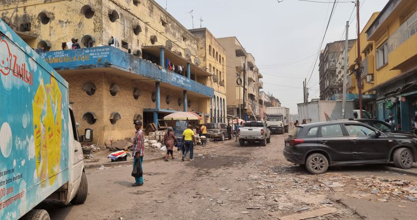
Needless to say, I didn’t hesitate for a moment to accept Michael’s invitation and make myself available for the project; after a few preparatory video calls, we found ourselves in chaotic Kinshasa, which extends south of the Congo River between a seemingly infinite number of hills cut by small valleys, giving life to a megalopolis with practically indefinable contours.
As soon as I set foot on Congolese soil, I immediately realized that, most likely, the movements in the capital would be the most delicate passages of the entire expedition.
In fact, leaving the N’Dili airport and crossing the avenues paralyzed by vehicles overloaded with goods and people that transformed the arteries of the city into a single market in continuous movement, was not easy and it took us a few hours to get to our hotel.
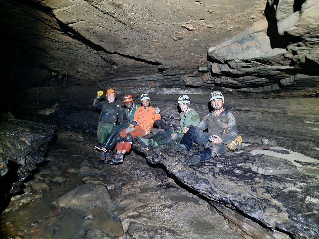
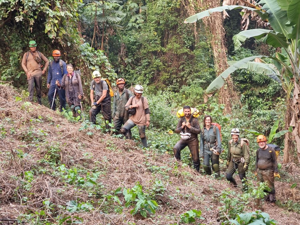
Here we met up with the other participants: Pascale Lahogue and Aurore Mathys from the RMCA of Tervuren, Bernard and Josiane LipsJean with Philippe Dègletagne from Lyon, Michael Laumanns from Berlin, Nadege Ngala Ntambvè, Jeaney Lusongo and Blaise Kabamba Baludikay from Kinshasa, Nicy Basebi Zonza from Congo Brazzaville, Prof. Roland Kakulè and Serge Mbangu Selo from the CGRM.
Time to load up the pick-up truck of the expert driver Serge and we set off towards Mbanza Ngungu, originally Thysville, in honor of Albert Thys, a Belgian engineer who at the end of the 19th century supervised the construction of the railway and built the town on these hills halfway between the capital and Matadi.
After leaving the province of Kinshasa behind us and entering that of Central Congo, the presence of some closely spaced checkpoints was explained to us by the military themselves: Rwandan rebel groups had been reported in the area and therefore the controls had been intensified.
A few hours later, however, we arrived without problems in Mbanza Ngungu, which is less than a hundred kilometers from the border with Angola.
From this quiet town where the decadent splendor of colonial villas still exerts a certain charm, for two weeks we moved incessantly south every day, to reach the karst area characterized by a karst with modest towers, imposing sinkholes surrounded by thick bamboo and majestic baobabs and springs that feed fields of cassava and banana trees.
As we moved south, the tracks became less and less passable and the villages increasingly modest and distant from each other.
In each of them we were greeted by a multitude of children, who came out timidly but at the same time curiously from the houses made of mud bricks and threw themselves in pursuit of our pick up. Sometimes they even followed us into the first rooms of the caves or sang songs outside waiting for us to come out, making our explorations even more suggestive. Indeed, one day, in the initial halls of the Ndimba Dimba cave, we came across a sort of baptismal rite of a local sect, whose followers wore blue robes and prayed in front of a group of large stalagmites.
Due to the unfortunately well-known vicissitudes that have marked the contemporary history of the country, the exploration of these karst areas has not been in-depth and the topographic documentation dates back to the last Belgian expeditions of the early 1980s.
During the first two expeditions of the GeoRes4Dev project, approximately 20 km of caves were mapped, characterized by large fossil galleries and active branches crossed by dark rivers sometimes interrupted by thunderous waterfalls that fall into the lower levels. About half of these kilometers detected were the result of explorations of new cavities reported by guides from neighboring villages and new sectors explored in those already known.
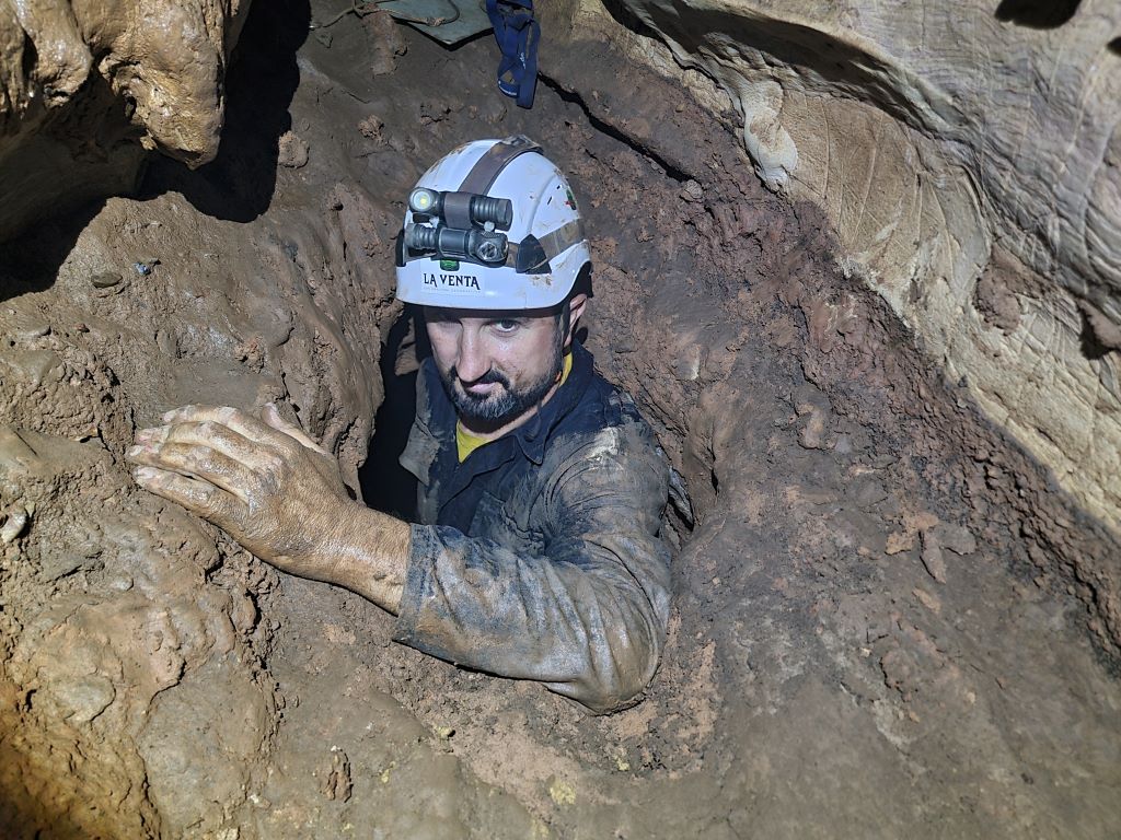
During the 2024 expedition, the first crossing of the Ngovo and Ngungi caves was completed, creating a system of about 10 kilometers of development, to date the thirteenth largest cavity on the African continent and above all the longest crossing, equal to about 6 km between one entrance and the other.
Even at the end of this year's mission, significant exploratory fronts were left open, starting with the new waterfall about 20 meters high identified in the section of semi-flooded galleries of the Ngovo-Ngungi system, from the base of which a large summit gallery could be seen; namely the Ndimba cave, which could hide new developments beyond the windy terminal rolling mill.
Achieving these results was truly exciting for the international team, both for the young Congolese students and for us explorers who came from far away, all united by a great passion for these troubled and complex places to decipher, where the rivers of the night seem even more mysterious and the sun is an indescribable orange.
Giuseppe Spitaleri
(Photos of Bernard Lips)